The government of Australia has asked the Google Inc to take back pictures of Uluru, which allowed the users to have a ‘simulated’ walk atop the rocks using the Google Map features. Parks Australia asked the search engine to take down the pictures, arguing they defy the ban on climbing Uluru, which was finally closed to the public in 2019 after decades of campaigning.
The rock’s original owners, the Anangu people, have been demanding Uluru be closed to hikers since 1985, as it is a site of sacred significance for indigenous Australians. “Parks Australia requested that the content be removed in accordance with the wishes of Anangu, Uluru’s traditional owners, and the national park’s guidelines,” a spokesperson told Reuters.
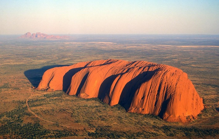
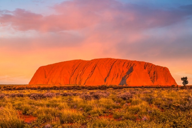
Uluru, or Ayers Rock, is a massive sandstone monolith in the heart of the Northern Territory’s arid “Red Centre”. The nearest large town is Alice Springs, 450km away. Uluru is sacred to indigenous Australians and is thought to have started forming around 550 million years ago. It’s within Uluru-Kata Tjuta National Park, which also includes the 36 red-rock domes of the Kata Tjuta.

Meanwhile, Google confirms that they have removed those images and features after they had received a request from Australian officials. A Google spokesperson told the Australian Broadcasting Corporation (ABC): “As soon as Parks Australia raised their concerns about this user contribution, we removed the imagery.”
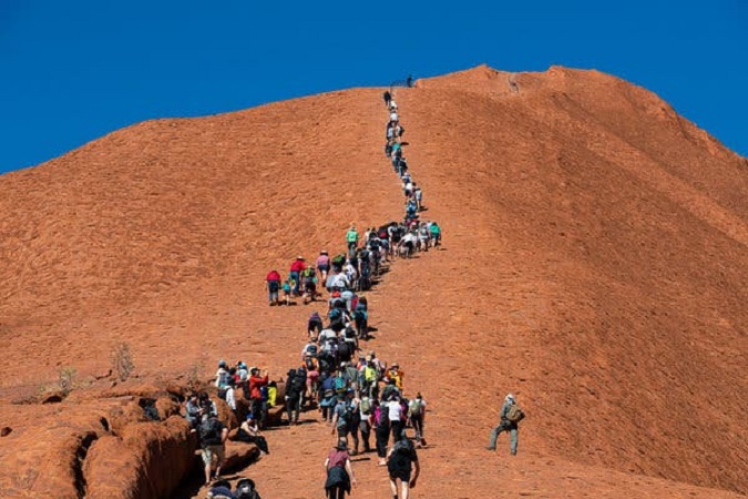
In October last year, tourists were filmed queuing in their hundreds for a last chance to ascend Uluru before the climbing ban came into effect on 26 October 2019. Journalist Oliver Gordon tweeted a video of the line of people waiting to make their way up the iconic rock. “One day out from Uluru climb closure, this is the line at 7am,” he wrote to accompany the clip, which showed a several hundred-strong queue at the rock’s base.

The visitors clearly chose to ignore the sign at Uluru’s base, which read: “We, the traditional Anangu owners, have this to say. Uluru is sacred in our culture, a place of great knowledge. Under our traditional law, climbing is not permitted. This is our home. Please don’t climb.”
Myths about Uluru
According to the Aṉangu, traditional landowners of Uluru, the world was once a featureless place. None of the places we know existed until creator beings, in the forms of people, plants and animals, traveled widely across the land. Then, in a process of creation and destruction, they formed the landscape as we know it today. Aṉangu land is still inhabited by the spirits of dozens of these ancestral creator beings which are referred to as Tjukuritja or Waparitja.
There are a number of differing accounts given, by outsiders, of Aboriginal ancestral stories for the origins of Uluru and its many cracks and fissures. One such account, taken from Robert Layton’s (1989) Uluru: An Aboriginal history of Ayers Rock, reads as follows:
Uluru was built up during the creation period by two boys who played in the mud after rain. When they had finished their game, they travelled south to Wiputa. Fighting together, the two boys made their way to the table topped Mount Conner, on top of which their bodies are preserved as boulders.


![The Top & Most Popular Seafood Bucket Restaurants in Dubai for you [Never Miss]](https://uae24x7.com/wp-content/uploads/2020/09/8-seafood-in-a-bucket-scaled-e1600739237403.jpg)
![Procedures for Renewing the Driving License in Abu Dhabi [3 Simple Steps]](https://uae24x7.com/wp-content/uploads/2020/07/Capture-9-e1595666454466.jpg)


